Story by Terry Boyle and photos by John Jeffrey
Starting the Trip South
Wednesday 6 March: day five; awoke at 6.45, feeling refreshed. John told me he had coughed for two hours during the night; he had shut doors between where he and I slept, so I heard very little of this. He planned to take a bus into the city to pick up our hire car by 8am; he had a slow trip through peak hour traffic on the bus. He returned a little before 11am, leaving again by 12.30 with me and our laundry. Sadly, the local laundromat was closed on Wednesdays! We then headed across the harbour to the MOTA - Museum of Transport and Aviation near Ponsonby. During March, entrance for people living in North Auckland was free!

There were many aircraft on display, including a DC3, a Tiger Moth, a Lancaster bomber, but most were out of reach. There were some audio visual displays, and a few items such as the tri-propeller from Kingsford Smith's plane that I could touch.

We were then able to catch an old Melbourne tram to the Western Springs Museum, about a mile distant, past the Auckland zoo. Here we managed to obtain a guided tour with Mike Austin, a knowledgeable and passionate steam engine enthusiast.

He showed us the massive beam engine which was assembled on site in 1876. Components were manufactured in Scotland, and the fly-wheel alone weighed 16 tons. It had eight sections. This engine pumped water from these springs to reservoirs at Khyber Pass from whence it was supplied to the city by gravity.

The engine was fuelled by a very soft coal from the Huntley mine near Hamilton. It remained in service till the 1940s.

Mike then showed us through a mock-up of the electric rail cars which will come into service in Auckland in 2014. These trains are being manufactured in Spain and utilize a 25k volt AC power system - the same as our trains in Brisbane. Currently, the suburban trains in Auckland are diesel electric. Wellington has had electric trains since the 1930s, but they run on a Dc system. John photographed me in the driver's seat of the rail car.

We could have spent many hours in this transport museum, but closing time was approaching, so we caught the tram back to the aviation centre where our car was parked. Here we spent the last minutes before closing time listening to excerpts from a documentary "Into the Wind", produced in 2011 which told the story of NZ men who flew with the RAF in WW2. In all, 55k airmen were killed during these bombing raids over Germany; of these, 1850 were from NZ, and nearly 5000 from Australia.

The jewel of the splendid Aviation Hall is the massive Sunderland Flying Boat.
The exhibits in these museums reminded me of events in my life when flying and travelling by train. Similarly, the stories told by the old war veterans reminded me of the wartime experiences of our relatives, especially those who did not return home.
We headed off to Hamilton and our tour of the Botanic Gardens. This town is a two hour drive southward on State Highway One; distance is approx 120km or 80 miles; had a spot of lunch in our motel before heading to the gardens on the southern outskirts of the city. Population of Hamilton is approx 150k; the nearby town of Cambridge was established about the same time as Hamilton, but it has not experienced the same level of growth. It has a population of only 30k.
Starting the Trip South
Thursday 7 March: We got away early, but spent 40 minutes in heavy traffic leading onto the harbour bridge; while John saw his doctor, I did some writing.
The area south of Auckland as far as Hawkes Bay has now been declared drought-affected, and joins the Northlands in being so.

Terry and Hamilton Gardens Guide Geoff Doube
The gardens covering 54 hectares are roughly rectangular in shape, and lie between the highway and the Waikato river; Our guide Geoff Doube gave us almost 4 hours of his time; most impressive displays were on the theme of Paradise, as depicted by various nations - cultures. these included Japan, China, India, USA, Italian Renaissance Italy. Email: geoff.doube@hcc.govt.nz I have yet to transcribe notes from this walk.

Japan

China

China

India
 USA
USA

Renaissance Italy

Ancient Egypt


Renaissance Italy

Ancient Egypt

Maori New Zealand


Maori Garden


Maori Garden

Our motel was quite old, perhaps built circa 1960s; it was located on a busy main road; when we reached our room on the second floor, John sat heavily upon the single bed, only to have it collapse under him; However, the room was spacious, and though lacking a fridge, it did have tea-making facilities. It was a little difficult to fill the jug from the basin tap! Graeme, the owner, did come and repair the bed after dinner. Judy, his wife, had done our laundry for a fee of $10 whilst we were at the Botanic Gardens. The motel had a restaurant where we had a most satisfying meal. For $20, we had a smorgasbord - roast beef or pickled pork, good range of vegies, plus desserts. Re the latter, we had a combination of 3 - fruit salad, passionfruit cheese cake, and brandy snaps! Overnight, the volume of traffic eased to a sporadic number in the wee hours between 2 and 4, reminding me of the days when we lived on a main road in Newmarket.
Heading for the Mountains
Friday 8 March: A fine sunny day; bought some groceries and filled up with petrol before we left Hamilton. This is extensive dairy country, though we did pass fields of corn, that were being sprayed from the air with a noisome chemical - fertilizer or pesticide, we did not know. We were headed for the town named National Park, located to the south west of the high volcanic mountains in the centre of the North Island.

After travelling for some time, John found we had taken a wrong turn and were on the way to New Plymouth, a town on the west coast. We eventually reached our destination, with no help from me and the G.P.S. device I had with me. In order to set a designated town as our destination, I had to know, and key in its location within a state or province. In large measure, I was ignorant of this information.

After travelling for some time, John found we had taken a wrong turn and were on the way to New Plymouth, a town on the west coast. We eventually reached our destination, with no help from me and the G.P.S. device I had with me. In order to set a designated town as our destination, I had to know, and key in its location within a state or province. In large measure, I was ignorant of this information.

We approached National Park from the north-east, and thus passed close to the north and N.W. flank of Tongariro and Mt Ruapehu. This gave John the chance to observe that steam was venting from high on the slope of Mt Tongariro. Once we were in town, my G.P.S. was helpful in locating our accommodation for the night at the Plateau Hostel, where are hosts were Andrea and Zeus. Their two year old son Tian confidently asked if we were members of a Backpacker's association, handed our room key to me, and skipped down the hallway to show us its location.

Terry with our bush guide Lyall Crump
John had pre-booked a guided tour for us that afternoon with Lyall Crump, the son of a well-known author and outdoors man Barry Crump. We were a little behind schedule, so Lyall met us as we ate our lunch in the spacious communal kitchen/dining room at the Hostel. His usual employment was as a tour bus driver; today he was assisting his partner Sarah, who ran the guided tours. We had been advised that we would have to provide the transport from the town, and this had been the source of some anxiety, lest our hire car prove unsuitable. We need not have worried.

From National Park, Lyall directed us northward along a bitumen road, the few kms to the village of Whakapapa. In doing so, we ascended from an elevation of 800metres to 1,100 metres above sea-level. These volcanic mountains, situated to the east and north-east of our location, rise to over 2,700 metres, and are snow-capped all year round. At the visitor's centre in Whakpapa, I was delighted to be shown a touchable scale model of these mountains, with their many vents and craters.

We then travelled a short distance to a graded track on which we walked through thickets of native vegetation, bordering the Whakpapa creek. Lyall named and described these grasses, shrubs and trees, the trunks of many being encased in a thick growth of moss.

The stream gurgled and roared as it descended the steep incline, through large slabs of rock and boulders. Aware that the whole north island of N.Z. was in the grip of drought, I asked whence came such a tumultuous stream. From the melting snow and glaciers on the summit of Mount Ruapehu, was the answer. Given the rugged nature of the terrain and the velocity of the stream, it was hard to believe Lyall's story that he has "surfed" it in a kayak.
At another location, a short distance downstream, Lyall showed us the creek's grandeur where it falls 11 metres into a large pool. Here, he guided me over large boulders to the water's edge - and gave me a very impressive word picture of the scene.
Description by Lyall Crump
Here, Whakpapa Creek drops 11 metres over a cliff, which may have been the end of a lava flow; lava could have been stopped by glacial ice; water is so cold as to make the fingers tingle. Walked 40 metres over large boulders to the edge of the pool at the bottom of the falls. Pool is 8 metres deep; has 2 curtains of water falling 11 metres directly into the pool; one curtain is approx 1.3 metres wide, the other about 30 cm. The pool is circular; looking at the falls, on the right-hand side, lava rocks have been twisted into strange shapes; colourful patterns on the rock - both algae and mineral; behind the falls is a semi-circular cave; the overhanging cliff was probably formed by the molten lava flowing over the glacier that was here. There are many ferns growing down from the roof of the cave; Further on, there is a broad-leafed tree, growing out horizontally for 3 metres from under the overhang. Then comes the two curtains of water; around and between them, the rocks are covered in moss. Beyond the falls, there is no longer an overhang; a number of broad-leafed ferns and trees. There is a fine mist coming off the falls, creating a rainbow in the middle; the mist is wetting the rocks on the far (left-hand) cliff; there, the rocks are very smooth. At the top of those cliffs are 10 metre high trees.


That evening, back in our Hostel, I learned that some of our fellow guests planned to spend the following day walking the famous trail along the high ridge between Mt Tongariro and Mt Ruapehu - "The Tongariro Alpine Crossing". We had not the time to do this walk, but I wondered if it were possible to get a taste of its ambiance by walking a short distance along it. We learned from Zeus that he would be making two trips to the commencement of the trail, taking walkers at 7am and again at 8am.
We decided to take our car, and left the Hostel at 6.30am, before our breakfast, or even a cup of tea. We took a wrong turning, and saw the 7am bus departing when we returned to town. When we reached the turnoff, a few kms beyond Whakpapa, there were a large number of vehicles parked on the main road - denied access along the 7km unsealed track because of limited parking. Zeus had told us of the need to be early, but the Park Ranger at the access barrier told us that the car park had been full before 6.30am. Many others, perhaps like us, had been attracted to the location by what I fancy was a rather rare phenomenon here - a continuing spell of fine weather!
We decided to take our car, and left the Hostel at 6.30am, before our breakfast, or even a cup of tea. We took a wrong turning, and saw the 7am bus departing when we returned to town. When we reached the turnoff, a few kms beyond Whakpapa, there were a large number of vehicles parked on the main road - denied access along the 7km unsealed track because of limited parking. Zeus had told us of the need to be early, but the Park Ranger at the access barrier told us that the car park had been full before 6.30am. Many others, perhaps like us, had been attracted to the location by what I fancy was a rather rare phenomenon here - a continuing spell of fine weather!

The sun had not yet risen, and a moderately strong cool breeze was blowing from the south-east as we began our walk along the access road. I was glad to be wearing several layers, plus a wind-cheater, for my ungloved fingers registered a temperature sub10 degrees! Because of the extremely dry conditions, a great cloud of fine dust enveloped us every time a car or bus passed us. Pneumonoultramicroscopicsilicavolcanoscis, a polysyllabic word from our schooldays, came to mind. It is a lung disease originating from the inhalation of fine particles of volcanic dust. John took some photos of the rising sun; and me? Well, I was content with my sample of the ambiance of this walk. We returned to our Hostel for a delicious, well-earned breakfast.
To Lake Taupo
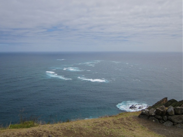
Saturday 9 March: The day was fine and quite hot as we headed away from National Park, heading north-east, retracing our journey of the previous day. We skirted around the northern flank of the volcanic mountains and joined the "desert road" at its northern end before driving eastward along the southern shore of Lake Taupo.
In less than two hours, we reached the town of Taupo, situated at the south-east corner of the lake. It was too early to book into our motel, so we did a little shopping in the town, taking advantage of a charity sausage sizzle to obtain an early lunch.

We then drove approx 30km northward to a place known as Orakei Korako, where we were ferried across the Waikato river by a friendly giant - an indigenous man who, on our return journey, directed the local cafe staff to provide us with a free pot of tea. By this means did we come to Hidden Valley, an extensive area of bush-clad hills and gullies.

Every day, 20 million gallons of hot water flow over the colourful silica terraces into the nearby river. Every few metres, there are steaming mud pools and embankments from which jets of liquid erupt and flow, gurgling and bubbling. Sometimes this thermal activity is in the form of a slowly enlarging bubble in a mud pool, at other times, it is a spasmodic fountain gushing or spurting metres into the air. All those sulphurous fumes, steam and hot water had not prevented the growth of grasses, trees and shrubs.


Extensive timber boardwalks traversed the hills and gullies, making access possible. Mind you, the walk involved hundreds of steps up, down and around the hilly terrain. The afternoon was quite hot, and I for one was pleased not to be spending the day trekking across the exposed rocky slopes high on Mt Tongariro. It took us just on two hours to complete our walk.
My G.P.S. helped us return to town and to the church - St Patrick's - efficiently and in time for Vigil Mass. The building is circular, and is within something akin to an enclosed cloister - no doubt very effective in keeping out the cold and windy weather. However, this was a warm, balmy evening. Mass was well-attended, among those present were several candidates taking instruction via the R.C.I.A programme. This was the 4th Sunday in Lent. The Gospel reading about the return of the prodigal son provided us with an enthralling topic of conversation over our evening meal. This we had in the restaurant attached to our motel - a large U-shaped complex, double-storied, with 17 rooms on each level of the 3 wings - close to 100 rooms. Layout of our ground-floor room reminded me of the motel we stayed at in Christchurch - even to me walking into the identical shelving adjacent to the en suite doorway! Dinner was a very reasonably-priced Scotch steak with all the trimmings
Sunday 10 March: We both slept well, and upon awakening, continued our conversation of the previous evening before arising and commencing the activities associated with breakfasting and departure. Today, we headed for Napier, where we were booked on a guided walk commencing at 2pm. Distance we needed to travel was approximately 278 kms . We wrongly estimated this trip could be done comfortably in 2.5 hours. From Taupo, we drove south-east, through sheep-grazing country, with long descents through rugged mountains. The road was narrow and gave little opportunity for impatient drivers to pass and to speed ahead.

Our hotel was in the heart of the C.B.D. at a corner where a number of streets met. These streets were narrow, and thronged with pedestrians. A large cruise ship was at anchor nearby. John had been advised that it would be difficult to find a parking spot near our hotel; it proved to be so, the nearest we found being several hundred metres away. Here is a simple comparison. Consider that our hotel was at the corner of Eagle, Queen and Wharf streets in Brisbane. The sea was as close as the river, and our car parked up Wharf street and around the corner in Adelaide street.


Carrying just the makings for our lunch and items we would need on our guided walk - backpack, water bottle, hat, etc - we walked to our hotel - and stepped into the 1930s! Our hotel was a low, chunky building, occupying an entire (though not large) city block. We took the lift to our room on the first floor, signs cautioning us to "mind the step", as the floor level inside the elevator did not quite line up with external floor levels.
Two single beds and various pieces of period furniture were in the room. While not dissimilar to the furnishings in a modern hotel or motel, the absence of plastic items and large expanses of glass and aluminium doors and windows did give the impression that we had crossed a threshold and were "on stage" in a play set in the 1930s.

In the room, there was a step-up into a curtained alcove, containing a hand basin and towel racks; leading off this alcove, a very narrow passage beyond a hinged door, gave access to a shower and toilet. These facilities were certainly not wheelchair accessible.

Likewise, the step up through a french door that gave access onto an extensive U-shaped balcony courtyard on the roof. From here I could hear the sound of the three metre swell breaking on the shingle beach two hundred metres distant.

Napier before its total destruction by the earthquake
Napier is named after a British General who captured the Indian city of Simla. It, and the nearby town of Clive are indicative of the background from whence came many of the original white settlers to this region. The town is situated on Hawkes Bay. It came into prominence at 10.27am on the morning of Monday 3 February 1931 when a 7.9 magnitude earthquake and consequent fire destroyed almost every building. The shoreline rose two metres, giving the city access to 3000 hectares of "new" land. Art Deco was the architectural style in vogue at the time that the city was rebuilt.

The new Napier in 1940
I found it fascinating to learn that the same issues and debates that have been raging in Christchurch since the disastrous quakes of 2010/2011 occurred here in the early 1930s - viz, disputes over insurance claims, questions about the future, ie, to abandon the site or to rebuild, the imposition of regulations re construction materials and the height of buildings.
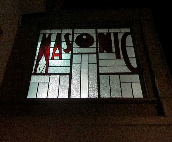
Like most buildings in Napier, our hotel was constructed of reinforced concrete. It had been rebuilt on the site of the original Masonic Hotel, and was opened in 1934. The Duke of York stayed here when he visited the city in 1935. Like other buildings in the C.B.D. its awning was now cantilevered over the footpath, rather then supported by posts near the kerbside.

Its vaulted foyer was zigzag, characteristic of the Art Deco style. Fortunately, we were able to take early occupancy of our first floor room, enabling us to make and have our lunch, plus prepare for the afternoon walk. When making our way from our car to the hotel, we had passed the Art Deco Centre, and were able to confirm our tour booking. Volunteer staff were dressed in period costume, and many items characteristic of the 1930s were on sale.

Its vaulted foyer was zigzag, characteristic of the Art Deco style. Fortunately, we were able to take early occupancy of our first floor room, enabling us to make and have our lunch, plus prepare for the afternoon walk. When making our way from our car to the hotel, we had passed the Art Deco Centre, and were able to confirm our tour booking. Volunteer staff were dressed in period costume, and many items characteristic of the 1930s were on sale.

Matilde, our german-born guide, set a cracking pace as she led our tour group through the city streets, all the while speaking authoritatively about the earthquake, its aftermath and the architectural styles in which the city has been rebuilt. For the rebuilders of Napier, the past had been destroyed; it could not be brought back. The most modern style of building would replace those that had gone. Styles popular in the U.S. at the time were Art Deco and Spanish Mission.

Art Deco gradually evolved through the early decades of the 20th century, coming to prominence and popularity at the Modern Decorative and Industrial Art Exposition held in Paris in 1925. It symbolised the new spirit of the age - science, technology, machines, the increasing independence of women and the overthrow of old conventions.

In the past, design inspiration had come from natural forms. Art Deco designers gloried in the machine. They were brash, vulgar and original. Favourite motifs were geometric, angular patterns and shapes, lightning flashes, leaping deer, dancing women, and the rising sun.

Another shape which easily identifies the style is the step silhouette, associated with New York skyscrapers which were stepped back to permit sunlight to reach the street.

In the past, design inspiration had come from natural forms. Art Deco designers gloried in the machine. They were brash, vulgar and original. Favourite motifs were geometric, angular patterns and shapes, lightning flashes, leaping deer, dancing women, and the rising sun.
Another shape which easily identifies the style is the step silhouette, associated with New York skyscrapers which were stepped back to permit sunlight to reach the street.

The 1931 earthquake not only destroyed buildings; it destroyed the telephone service and other utility services, such as electricity. As a consequence, Napier was one of the first cities to install extensive underground power supplies. When the quake struck, it was fortunate that H.M.S. Veronica was in port. The ship was able to radio news of the disaster to the outside world, and sailors from the vessel helped in the rescue of survivors. The death toll was 162 in the city, a further 90 people in the region. Many wooden buildings survived the quake but were destroyed in the subsequent fire; one of the few buildings to survive had been built using reinforced concrete.


Trees tended to be unaffected by the quake. They included an impressive row of Norfolk Island pines planted along the foreshore in the 1880s. They have grown to maturity and each evening of the year, they are illumined by coloured lights, giving a festive touch to the city.

In the cool of the early evening, we enjoyed a stroll to the beach, and after a hearty meal of bangers and mash at the Irish Bar on the ground floor of our hotel, we walked along Marine Parade, under those coloured lights in a vain attempt to find a memorial fountain. We did come across a stone plinth, raised to the memory of 10 young men who lost their life on Good Friday, 16 april 1897, in an attempt to rescue people from the flooded town of Clive. We also had a pleasant conversation with a British couple, holidaying in N.Z. for a month, who had just driven from Wellington that day, and who spoke about the excellent displays in the Te Papa National Museum in that city.

In the cool of the early evening, we enjoyed a stroll to the beach, and after a hearty meal of bangers and mash at the Irish Bar on the ground floor of our hotel, we walked along Marine Parade, under those coloured lights in a vain attempt to find a memorial fountain. We did come across a stone plinth, raised to the memory of 10 young men who lost their life on Good Friday, 16 april 1897, in an attempt to rescue people from the flooded town of Clive. We also had a pleasant conversation with a British couple, holidaying in N.Z. for a month, who had just driven from Wellington that day, and who spoke about the excellent displays in the Te Papa National Museum in that city.
Off to Wellington
Monday 11 March. Today we had to travel the 320km to Wellington, to arrive there in plenty of time for John to catch a plane at 4.45 to Auckland. Estimating that the journey should take between 4 and 5 hours, we planned an early departure. It was pleasing to be leaving just after 7.30. However, we had some difficulty in locating, and remaining on the road to Wellington. After an hour, we had reached Hastings, Napier's "twin" city.
There were many apple orchards in this part of the country. Roads were narrow, and on several occasions we noted lines of traffic caught behind a large, slow-moving piece of farm machinery en route to a field on the outskirts of a town or village. Better progress was made once we were "on the open road". Once again, we came across a low-flying aircraft - crop-dusting, possibly spreading super phosphate over pasture land. By 10.30, we had travelled over 200km and were ready for a comfort stop.
The small town of Masterton provided us with that opportunity. A local cafe provided access to the amenities located in the neighbouring theatre, and supplied us with two pots of tea, and two 3-minute timers to ensure that we gained all the benefits of the brew - colour, flavour and, anti-oxident properties! Roadworks slowed our pace as we headed through mountain ranges and descended into the Hutt valley. From here, our track became a multi-lane freeway, leading us into and beyond the C.B.D. of the nation's capital city.

My G.P.S. device helped guide us to our destination in Vogeltown, where we arrived just before 1.30pm.We were made most welcome by Willie Ryan, owner of Finnimore House, the b. 'n b in which I would be staying with Rhonda.


Finnimore House, built about 1873, and at one time occupied by Julius Vogel, Premier 1873/1875, is about 3km west of the city centre and harbour, of which it has a fine view. It is over 100 metres above sea level, near the top of one of the many steep hills in Wellington. Down a long, zig-zagging road, it is perhaps 1.5km from Wellington Hospital, where Rhonda was attending a C.P.E. workshop.

After a satisfying lunch, John had time for a short rest before returning the hire car and catching his 4.45pm flight back to Auckland. In a phone call to me that evening, he spoke of the great view he had of Tongariro and Ruapehu as he flew over these mountains.

Flightless and extinct Moa Te Papa Museum Wellington
Tuesday 12 March. Before leaving Brisbane, I had arranged to have two guided tours in Wellington today. The first was at Te Papa Museum. Bruce, my guide, was at the door when I arrived by taxi. The hour long tour (actually, nearly 90 minutes) - see appendix for notes - costing NZ$20 - seemed brief, and was over all too quickly. It was not until some time later that I wondered if I could have asked and paid for, another hour. Later, I took another taxi the short distance to the Museum of Wellington City and Sea. Unlike the previous tour, this one was free, not time-limited, and was far more "hands on". It was very enjoyable.
Rhonda and I enjoyed a little extra time in Wellington before flying home to Brisbane and John was safely back in Auckland, preparing to return to resettle in Brisbane after almost two years in New Zealand.
Rhonda and I enjoyed a little extra time in Wellington before flying home to Brisbane and John was safely back in Auckland, preparing to return to resettle in Brisbane after almost two years in New Zealand.